Little Lakes Basin 
Distance: 4.2 - 7.7 miles (round trip)
John Muir Wilderness Area, Inyo National Forest, near Mammoth Lakes in California's Southeastern Sierra
A wonderful hike visiting a series of scenic lakes nestled in a gorgeous valley surrounded by 13,000-ft peaks. Side trips lead to Morgan and Mono Passes along with a number of other lakes.
See Trail Detail/Full Description
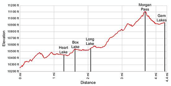
- Distance: 4.2 miles (round trip) to Long Lake
7.4 miles (round trip) to Morgan Pass
7.7 miles (round trip) to Gem Lakes - Elevation: 10,200-ft. at Trailhead
10,560-ft. at Long Lake
11,110-ft. at Morgan Pass
10,930-ft. at Gem Lakes - Elevation Gain: 360-ft. to Long Lake
900-ft. to Morgan Pass
730-ft. to Gem Lakes - Difficulty: easy-moderate
- More Hikes in:
Mammoth Lakes / Bishop / California's Southeastern Sierra
Why Hike Little Lakes Basin
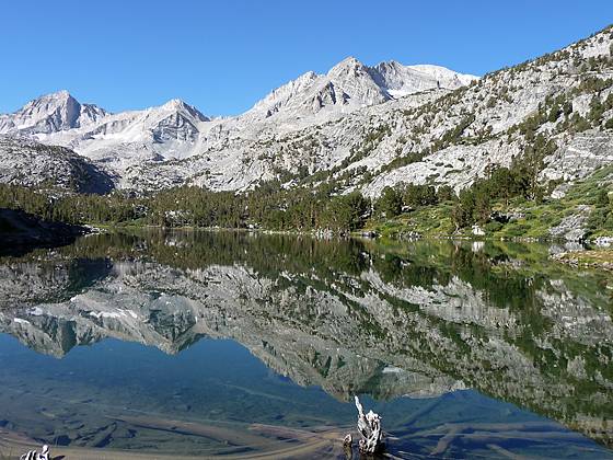
The Little Lakes Basin is truly an extraordinary place. An easy trail ascends along a succession of gorgeous glacial carved lakes set amid pretty meadows framed by the spectacular 13,000-ft peaks of Bear Creek Spire, Mt. Dade, Mt. Abbot, Mt. Mills and Mt. Morgan. Along the way spur trails and routes leading to unseen lakes and two major passes invite further exploration.
Starting at 10,200-ft., this high elevation trail requires minor effort and elevation gain to access it’s amazing views, shimmering lakes and lofty granite peaks, making the area a popular destination for hikers, backpackers and fishermen. Due to its popularity the small trailhead parking lot fills early in the day, typically before 9am during the height of the summer. The closest overflow parking area is located 0.3 miles back down the road. My advice is to get an early start or plan on extending you hike with a walk up the road.
Elevation Profile

Trail Resources
Trail Detail/Full Description / Trail Photo Gallery / Trail Map
Basecamp(s) Information:
Mammoth Lakes / Bishop
Region Information:
California's Southeastern Sierra
Other Hiking Regions in:
California
