Lower Butler Wash 
Distance: 3.0 - 5.4 miles (round trip)
BLM, Monticello, Utah office, near Bluff in Southeast Utah
This short, moderately-easy hike leads to a stunning rock art panel along the north side of the San Juan River.
See Trail Detail/Full Description
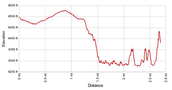
- Distance: 3.0 miles (round trip) to Lower Butler Wash
- Elevation: 4,480-ft. at Trailhead
4,270-ft. at Lower Butler Wash - Elevation Gain: -210-ft. to Lower Butler Wash
- Difficulty: easy-moderate
- More Hikes in:
Bluff / Bears Ears NM / Southeast Utah
Why Hike Lower Butler Wash
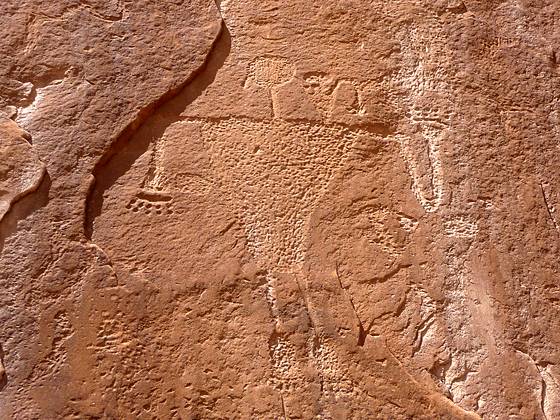
This short, easy hike leads to an amazing rock art panel along north side of the San Juan River. After traveling through open desert on a dirt road the trail drops into Lower Butler Wash on an old wagon trail. Once in the wash the trail heads down canyon, passing a few small ruins and other minor rock art panels on its way to the river. The petroglyph panel, just to the east of the confluence of the Butler Wash and the San Juan River, includes hundreds of animal, plant, human and geometric images.
Elevation Profile

Trail Resources
Trail Detail/Full Description / Trail Photo Gallery / Trail Map
Basecamp(s) Information:
Bluff / Bears Ears NM
Region Information:
Southeast Utah
Other Hiking Regions in:
Utah
